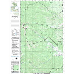
Recently Updated for 2025 to include new camps, trails, and trailheads in Philmonts South Country.
Reference the Itinerary Guidebook to find out which sectional map you need for your trek!
Features:
- Contour Intervals: 50 feet
- Scale 1:31680
- Wateproof ink, printed on water-resistant paper
- Shaded Topographical Relief
- All map information is surveyed & processed by Philmont's GIS department.
- Map Size: 36"x26"
- Printed on Front/Back
- 2025 Printing
Reviews
-
South section map
Exactly as expected. Good size, waterproof. Great quality for the price. Shipped fast!
-
South country map
Excellent.
-
I note that the two sides of the south country map have slightly different scales so that when I tried to piece the two maps (I bought two) togther, the borders did not match. One side has 15/16 inch per half mile and the other has one inch per half
I reported this issue to the Philmont camping e-mail and was told they would relay the issue to their map dept.
-
South Country sectional chart
Great chartt!


